
Mount Church
When my friend Dean approached me about taking on Mount Church again, I had to do some thinking. This one hasn't been on my radar for a while, but was still is in the "attempts" rather than "ascents" category. With six years having passed since my prior two attempts in April and June of 2022 and the memory of the brushy approach fading, I figured another trip would be fun in a type 2/3 kind of way. We picked May 31 for our "going to Church on Sunday" trip.
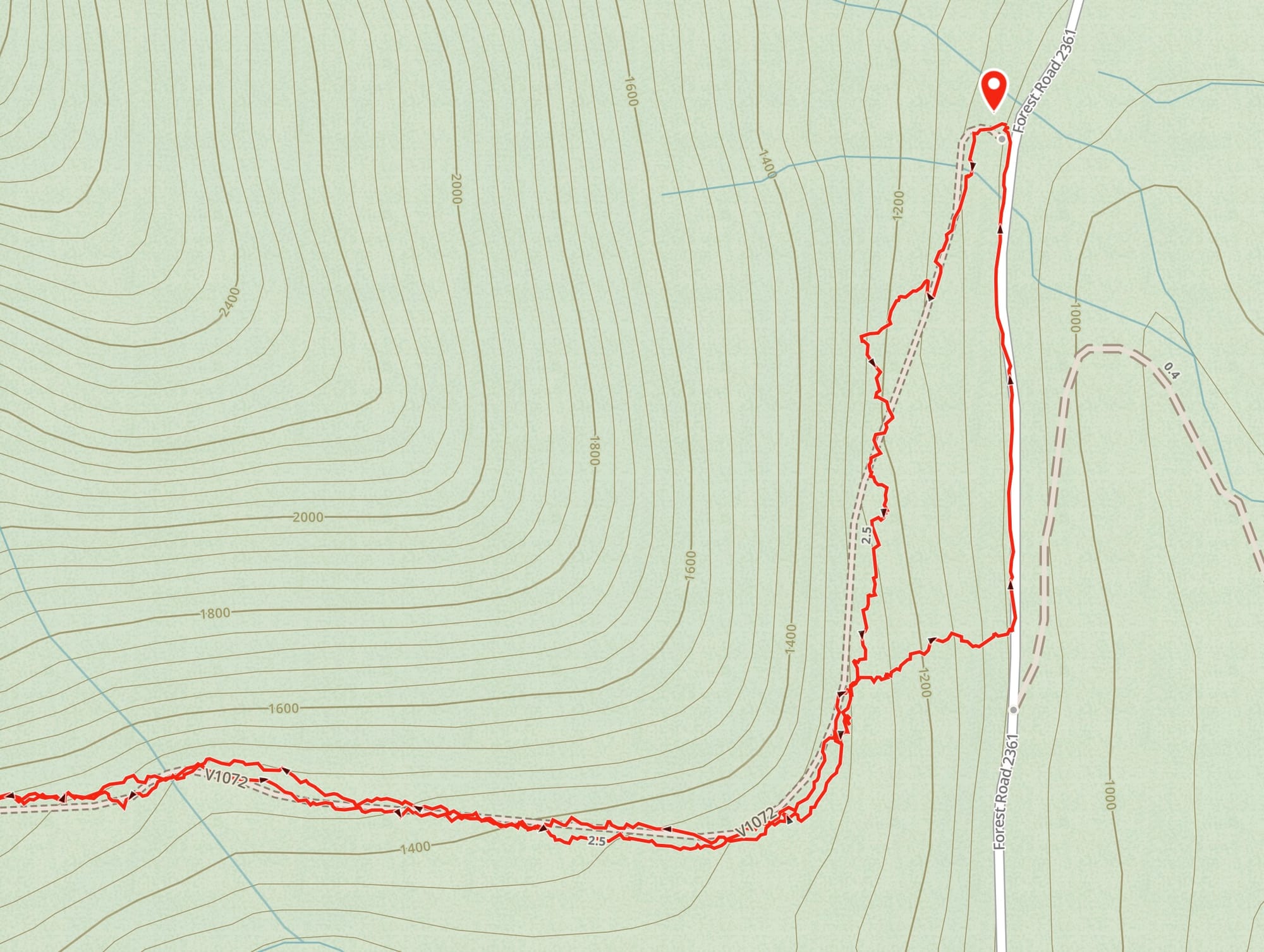
The forest road entrance that serves as a trailhead looked even more overgrown than last time I was here, a sign of what was to come. We debated shoe and gear choices. In June of 2022, I turned around because of lingering snow on the upper slopes, so I talked our group into bringing an ice axe, which ultimately proved unnecessary and in fact slowed us down a lot due to catching on the brush we had to navigate. We set out from the trailhead at 7:40 AM and if I had to do it again, I'd aim to leave even earlier, e.g. 6:00 AM.
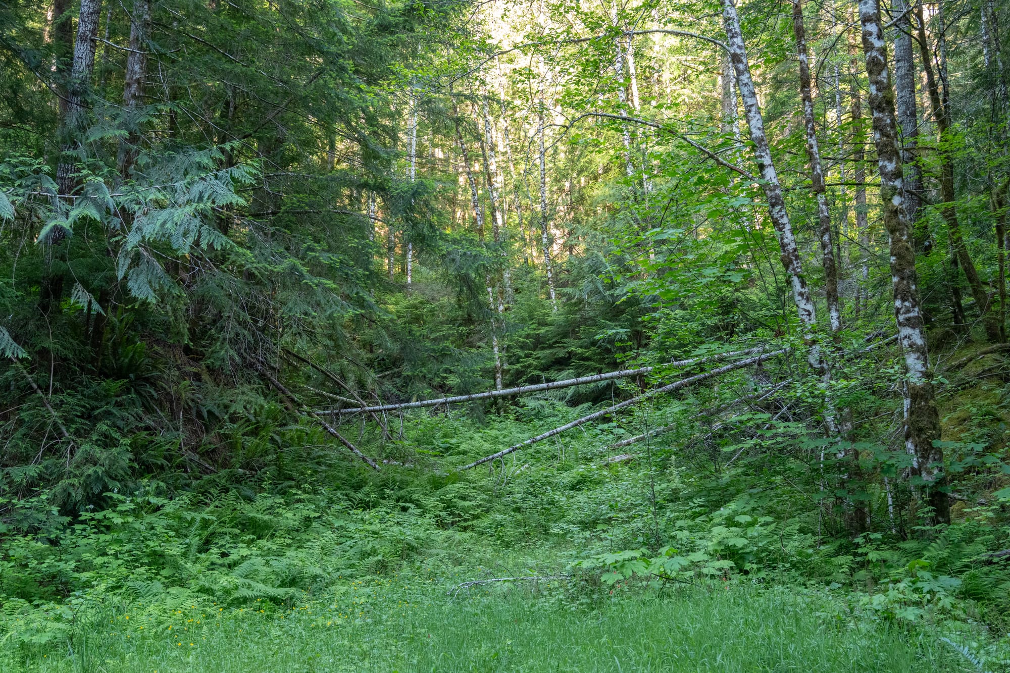
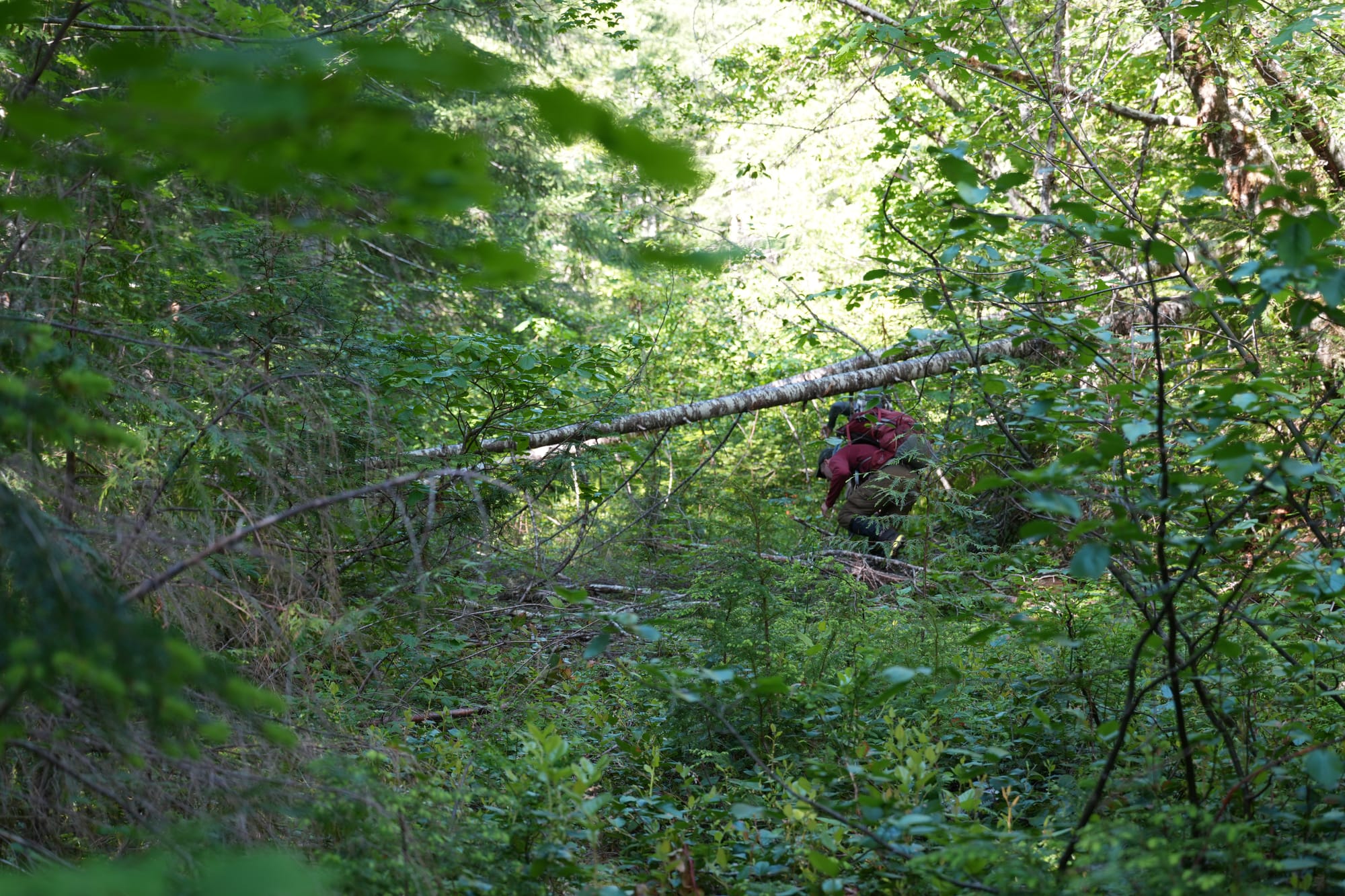
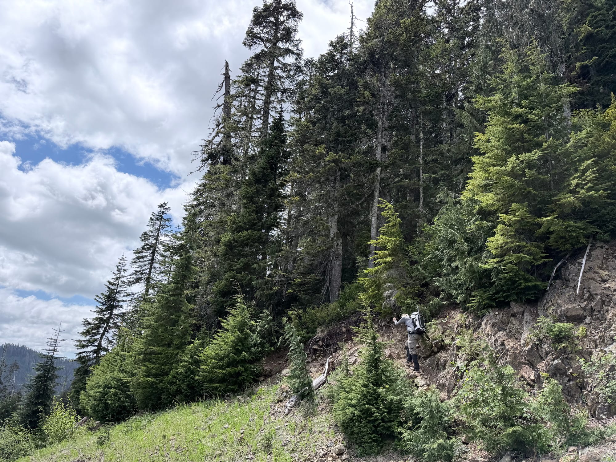
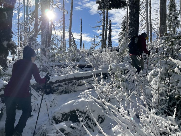
The first mile was painfully slow as we picked our way through the huge trees and rocks blockading the road. A Peakbaggers report from Fay Pullen in 2011 described this road as "super decommissioned", so 15 years later, it's now "super-super decommissioned". We left the road to the right at times, faring better through the forest, but in retrospect, it would have been quicker to walk down Forest Road 2361 (see map below) and cut up the hillside, bypassing the first section of terrible road. Eventually, we found some semblance of the road and navigated through the multiple washouts, some containing a little water.
As we moved up the road, we heard the characteristic "whump whump" call of the male Sooty Grouse and soon we spotted him in the trees to our left. I pulled out my digital camera in attempt to capture an image. Unable to get a suitable shot, I put it back in my chest carrying pouch and reached for my phone, capturing a marginally better image.
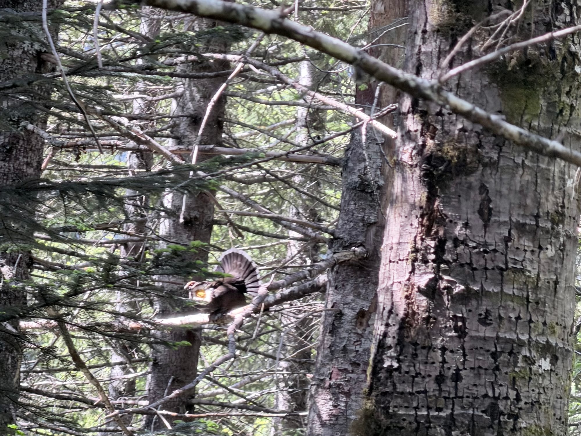
Unfortunately, I neglected to zip up the camera pouch before we plunged back into the brush. About 5 minutes later, I reached down for the camera and realized it was missing. What the $!@#? How did that happen? I called out to my partners, "I've lost my camera", numbly playing back the last few minutes in my mind trying to figure out where it could be. I was concerned that it was gone for good, as the road is so densely covered with brush that it would be easy to lose something even as large as a camera. We retraced our steps back to where I had taken a photo of the grouse, thinking perhaps I set it down when I reached for my phone, but it wasn't there. We spent the next 30 minutes combing the road back and forth. At one point, Dean mentioned that he thought I had crossed one particular washout a little higher than he did. As I slowly walked to this spot, my eyes scouring the ground, I found the camera resting at the edge of the washout, barely touching a small stream. Unbelievable! It must have fallen out as I bent forward to cross the ravine and somehow I didn't feel or hear it drop. Looking for damage, the only issue I found was a little scratch on the protective UV filter, which saved the lens itself from damage. Relieved, we moved on.
After missing the right turn for the upper forest road, we consulted the GPS and eventually located it. Taking the deteriorated road upward, like last time, we found that the brush eventually thinned out, making travel easier. The water source I used previously (coordinates: 47.45988, -123.49584) was still there and we stopped to replenish our supply. Moving on, we finally reached the spot where we would leave the forest road at approximately 3,200 feet of elevation.
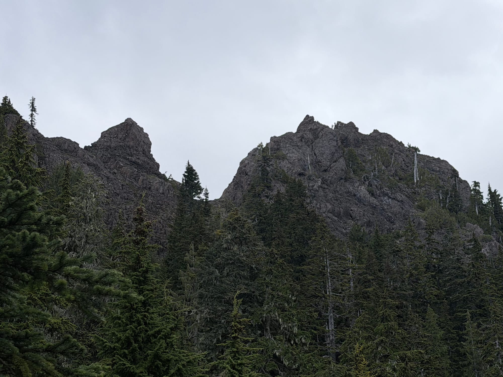
We loosely followed the GPS track from Chris Strode's Peakbagger report which mirrored my downhill track from the last trip. He commented that following the gully on climber's left was easier than staying on the ridge at climber's right. We aimed for that left side track and slowly made our way up, gaining 1,000 feet in under a mile. For me, this was the most difficult part of the trip, having just fought my way through the forest road approach and almost losing my camera, I was using most of my remaining energy to get up this section. We rested briefly at the spot where I turned around last time. It was here where I encountered snow on the previous trip, but today, there were only small isolated patches. We then traversed climber's right below the cliffy band of rocks on the ridge, aiming for a notch where Chris' GPS track led. Due to increasing fatigue, I thought about stopping under the ridge, but ultimately I kept going up to the notch.
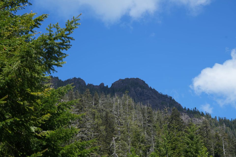
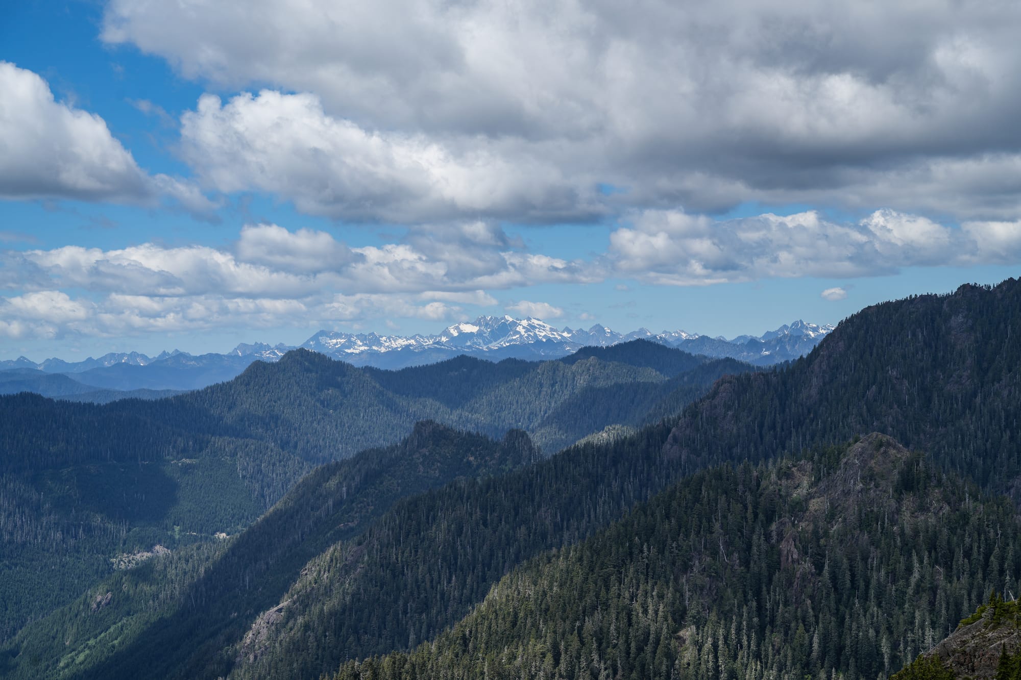
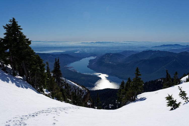
Upon reaching the notch, an expansive view opened up to the north and Mount Olympus came into view.
On climber's right at the notch, what appeared to be the final scramble lay before us. After some rest, I followed my partners up this route, which appeared to be the same route taken by Chris. After making it part way up this 3rd class section, I heard from my partners ahead that it was looking more like 4th or 5th class and they were turning around. Dean could see from his vantage point that there was another, probably easier route if we had stayed below the ridge to climber's right rather than aiming for the notch.
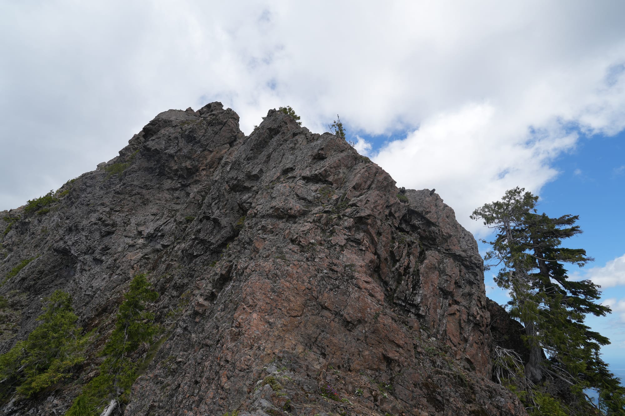
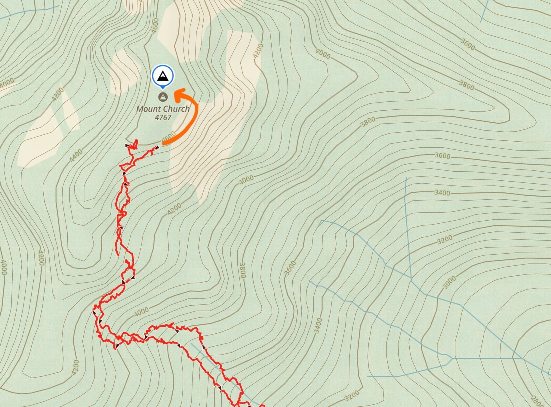
Dean was faring better than I was at this point and after down climbing the false summit, he traversed climber's right in front of the ridge to approach the true summit from the east, which proved to be mostly third class terrain. My legs were fatigued enough that I didn't want to test them with this final (higher stakes) scramble and I felt the best option was to rest and preserve my energy for the long trip back. After about 30 minutes, Dean returned with the good news that he had successfully summited.
It was a long walk out and with all the brush and obstacles everywhere, I don't think we were much faster than on the way up. Toward the end, we did manage to save 20-30 minutes by cutting away to Forest Road 2361 for a short road walk back to the vehicle.
This is actually one of the better sections of the road
With the growth of brush on the forest road in the last six years, Mount Church has become a more difficult mountain to access. Without a brush-clearing effort to improve access, the approach will increasingly become more challenging and this forgotten corner of the Olympics will become even less traveled. Perhaps a more direct route avoiding the road is now a better option. As it stands, I'm comfortable leaving this one in the "attempt" category.
Starting elevation: 1,084 ft | Elevation Gain: 3,411 ft | Distance: 10.1 mi
Equipment: poles, helmet, ice axe (not used)
Comments ()