Mount Whitney
As the tallest mountain in the lower 48 United States, Mt. Whitney is a popular destination for hikers and peak baggers. Having previously summited Mt. Rainier, I was naturally drawn to another mountain with higher elevation. I planned a two-day hike and was able to secure a permit for an early May climb. While planning the hike, I considered taking the mountaineer’s route, which is about 14 miles roundtrip to the summit. Since I was going alone, I decided to take the easier approach on the Whitney main trail, a longer route at 22 miles roundtrip.
To acclimate to the high altitude, I spent several hours at Horseshoe Meadow (approx. 10,000 ft.) the day before the hike. After a good night’s sleep in Lone Pine, I set out from the Whitney Portal trailhead at about 9 AM. Conditions were perfect, if a little on the warm side at about 75 degrees. The trail was in great shape, at times feeling more like a manicured park trail than one traveling through wilderness.
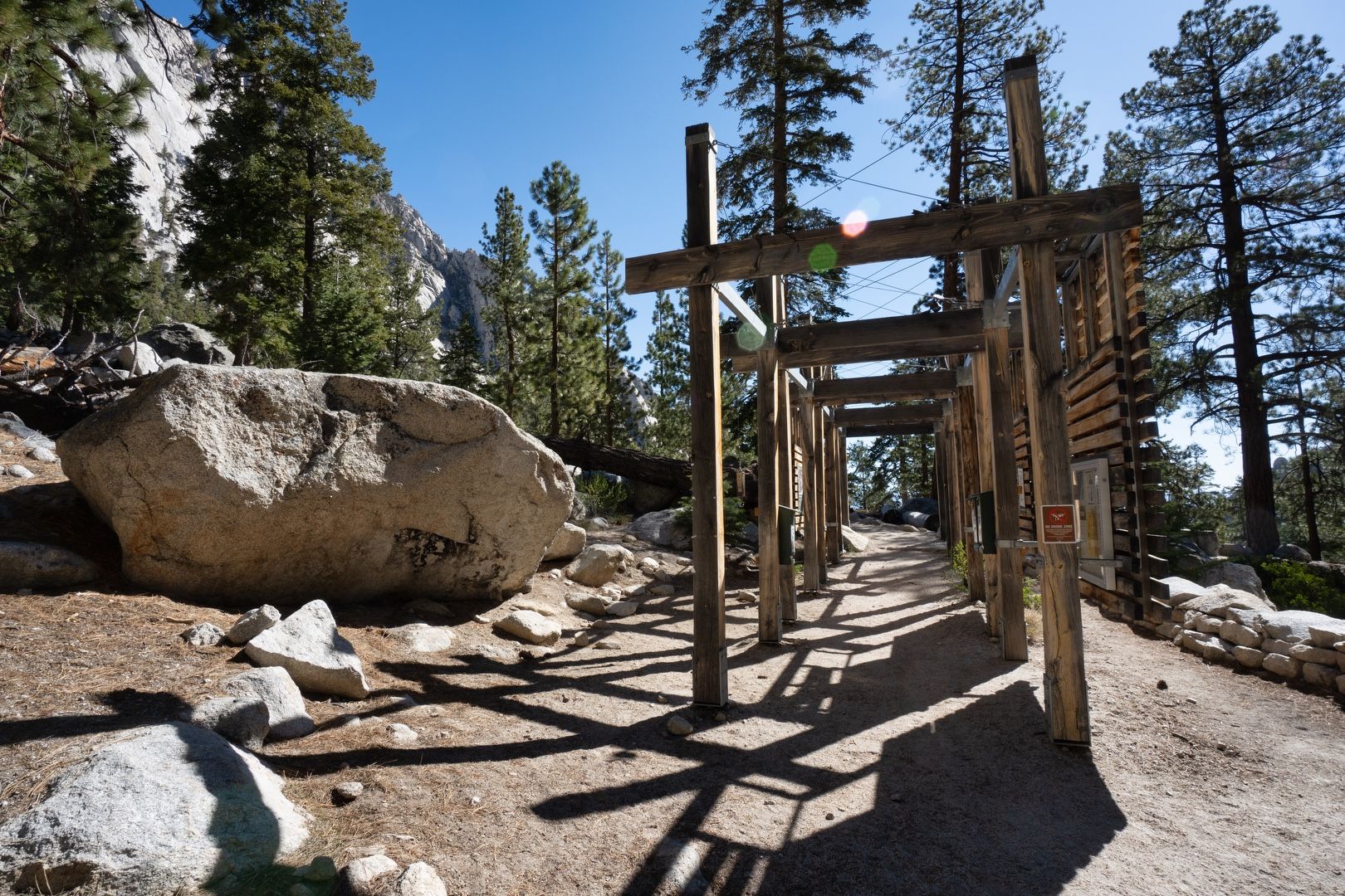 The portal beckons
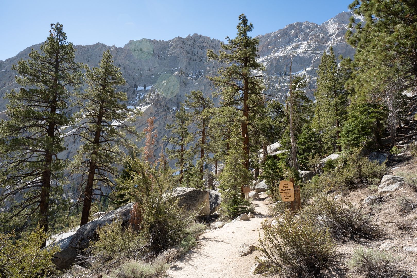 Entering John Muir’s wilderness
Stopping for lunch at Lone Pine lake, I drank in the beauty of my surroundings. I retrieved some water from the lake and discovered that my Sawyer Squeeze was filtering very slowly, but eventually I was able to get the job done.
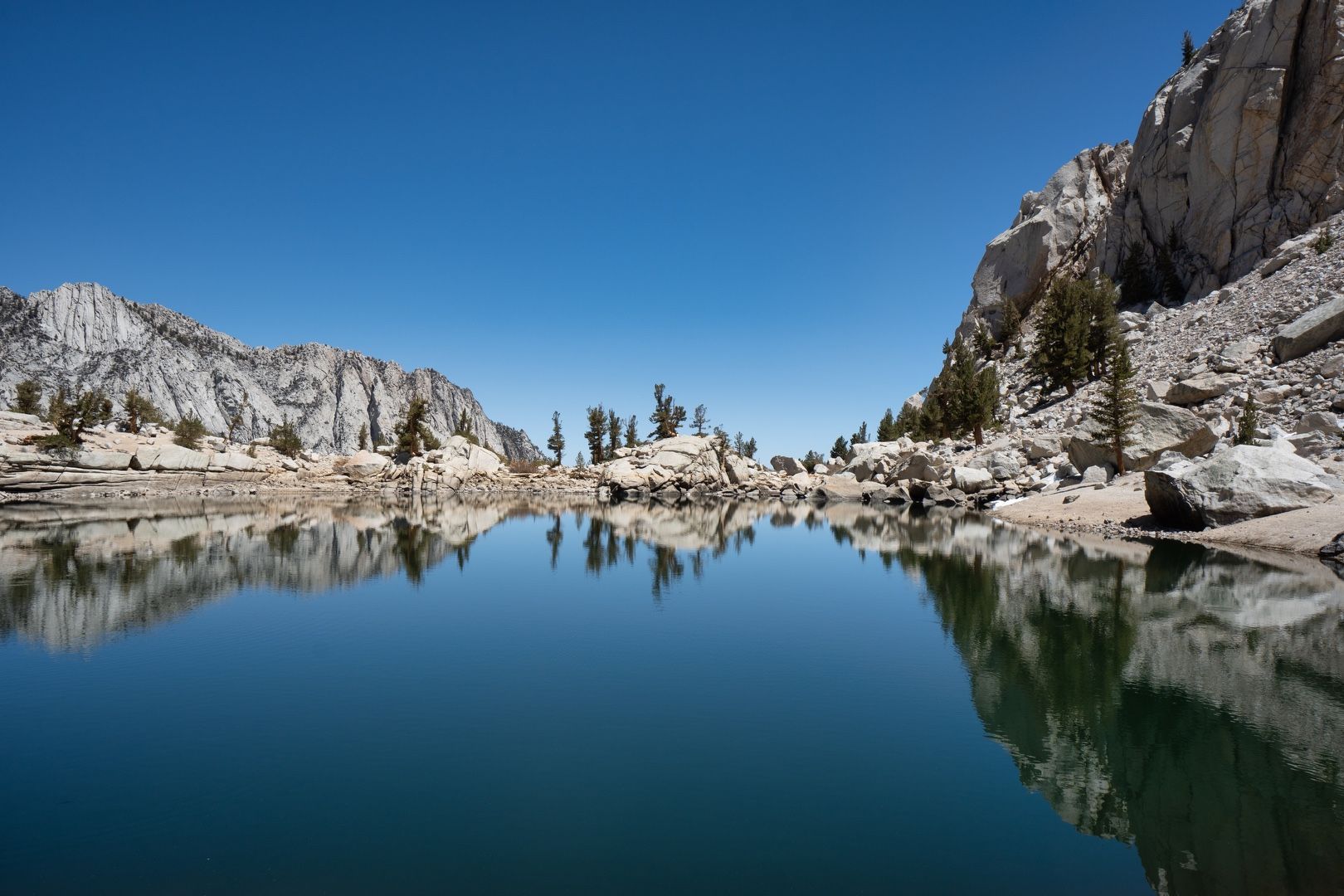 Reflecting on Lone Pine lake
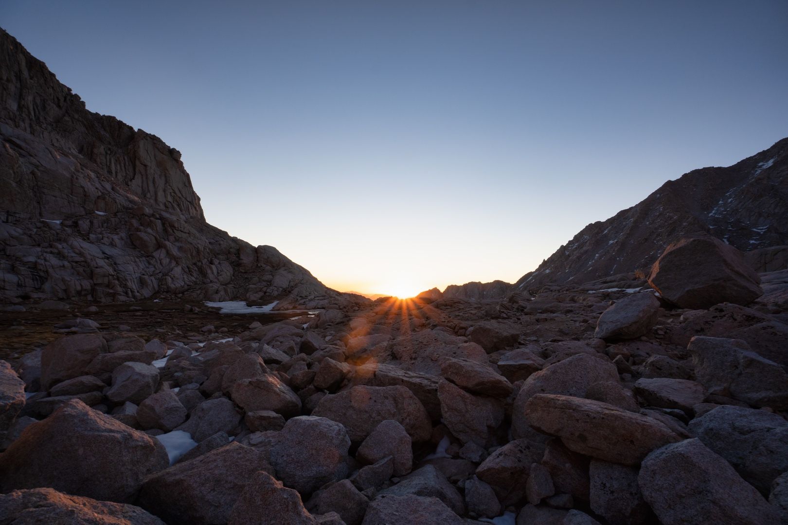
After the lake, the trail passed through the meadows of Bighorn Park and Outpost Camp. Beyond this, the trees thinned out and I entered the alpine zone, with dropping temperatures and an unrelenting sun. Snow began to make an appearance on the trail, but it was easily navigable without traction devices.
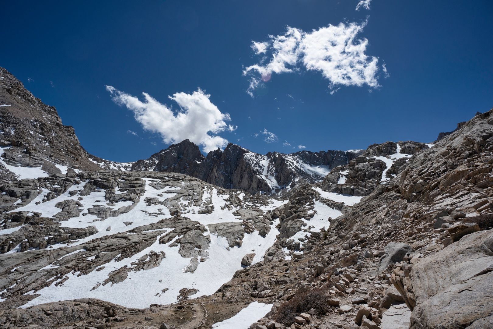 Getting that alpine feeling
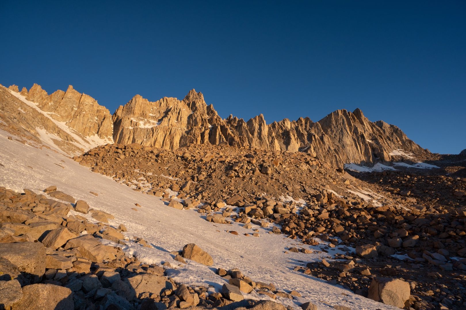
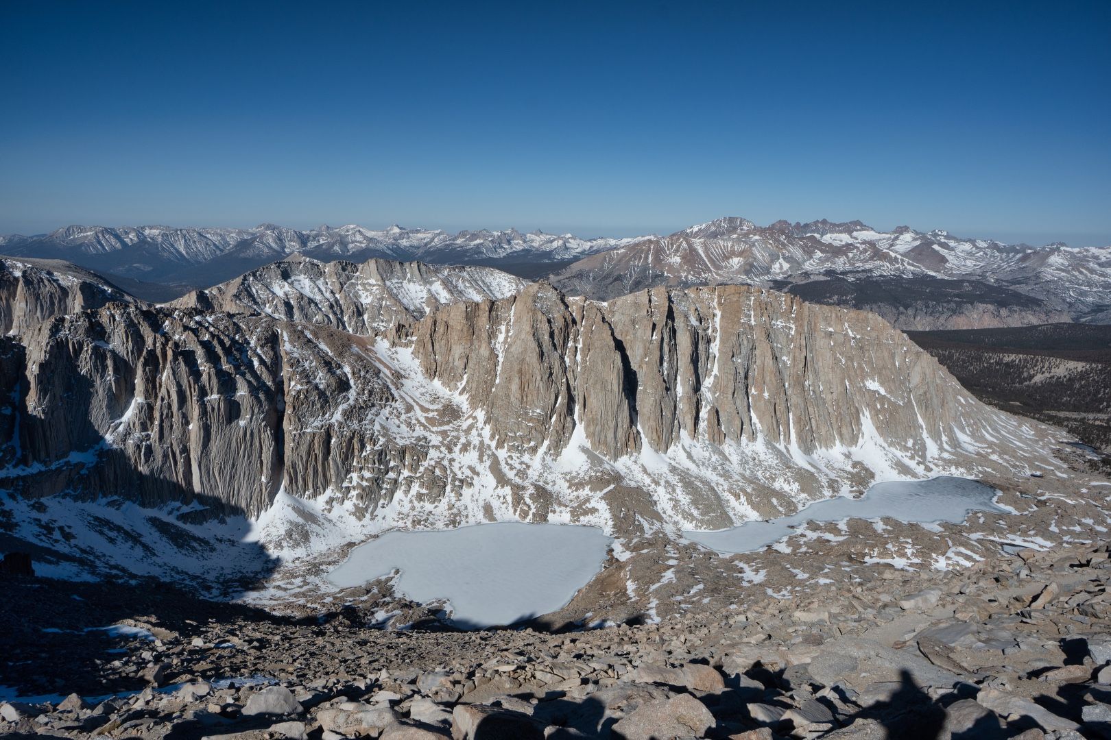
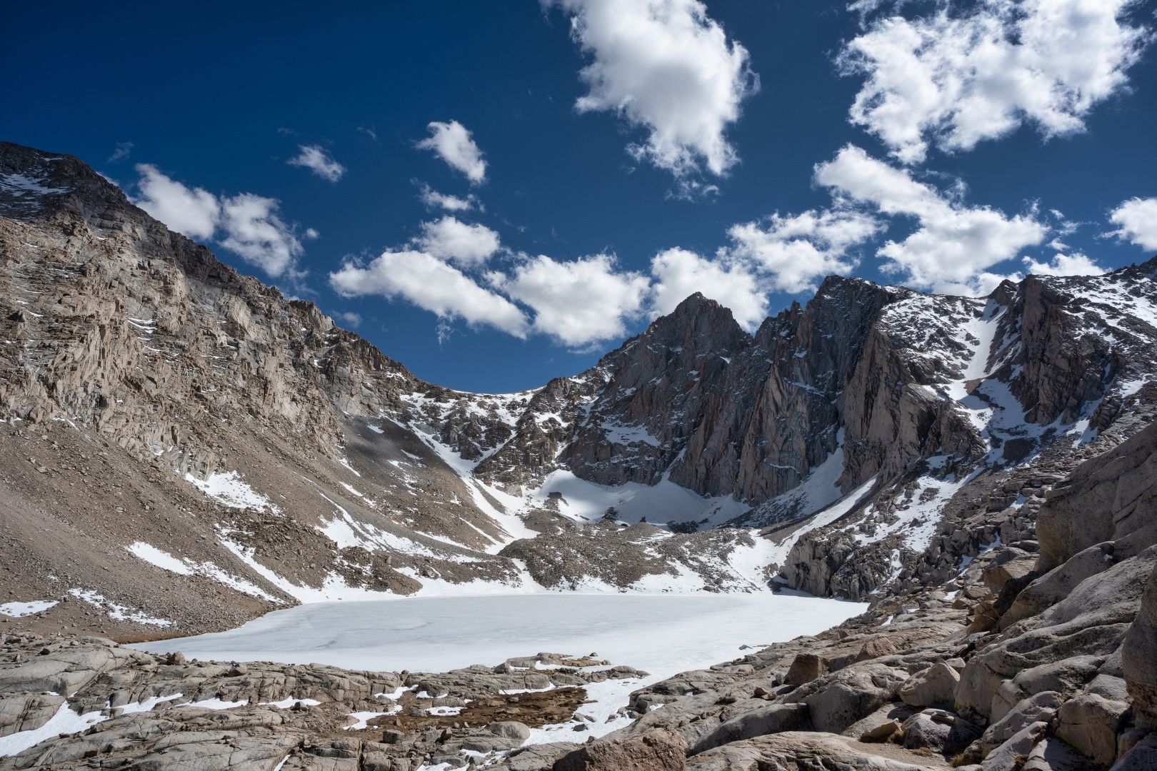 Frozen Consultation Lake
My planned destination for the evening was Trail Camp, situated near a tarn at about 12,000 feet. A few hikers were already there when I arrived, but I was able to find a nice flat area that easily accommodated my bivy sack. Water was available from the tarn, but the levels appeared quite low and I wondered if it would still be there after the snowmelt ended later in the season.
While setting up my camp, I met a few other hikers camping nearby. One couple had made a summit attempt the previous day, going up the chute adjacent to the switchbacks without microspikes or crampons. They apparently became stranded there, unable to climb up or down climb due to the risk of an uncontrolled fall. Thankfully they were able to get off the chute and onto the switchbacks with the aid of another hiker. I met another lone hiker from Bangladesh who was wearing blue jeans and had become separated from his group. He turned back on the switchbacks and they pushed forward, but he had no way to communicate with them and was simply waiting for them to return (which they later did around dusk). I saw firsthand the wide variety of experience of those who attempt to climb this mountain, along with the risk that this brings.
Another hiker I met at Trail Camp, Steve C., runs the Whitney Zone Forum. He is 70 years old and has been hiking the mountain for decades. On this trip, he was planning to perform some trail maintenance by digging out the snow-covered “cables” section on the switchbacks. We shared a few stories before the sun dipped behind the mountains and it was time for bed.
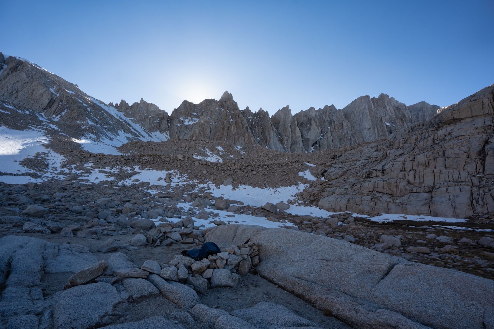 Bivy at Trail Camp
After a fitful night of sleep made more uncomfortable by a deflating mattress pad, I woke at 5 AM to a glorious sunrise. Already seeing day hikers passing through our camp, I got up to start my summit day. Soon after hitting the trail, I met Alan and Jolene, a husband and wife from the Sacramento area who had started their hike at 2:30 AM. We kept in touch at various stopping points on the way up the switchbacks.
 Here comes the sun
The sun cast a warm glow on the ridge above us. Initially I considered ascending the chute with my crampons, but missed the takeoff from the switchbacks to make it over to the snowfield. Finding myself on one of the best trails I had ever seen, I decided to keep going up the switchbacks, not only for the ease of the climb but to admire the trail design. I felt myself breathing a little harder on the ascent, now well above 12,000 feet. With frequent hydration, snacks and a manageable pace, I thankfully avoided altitude sickness.
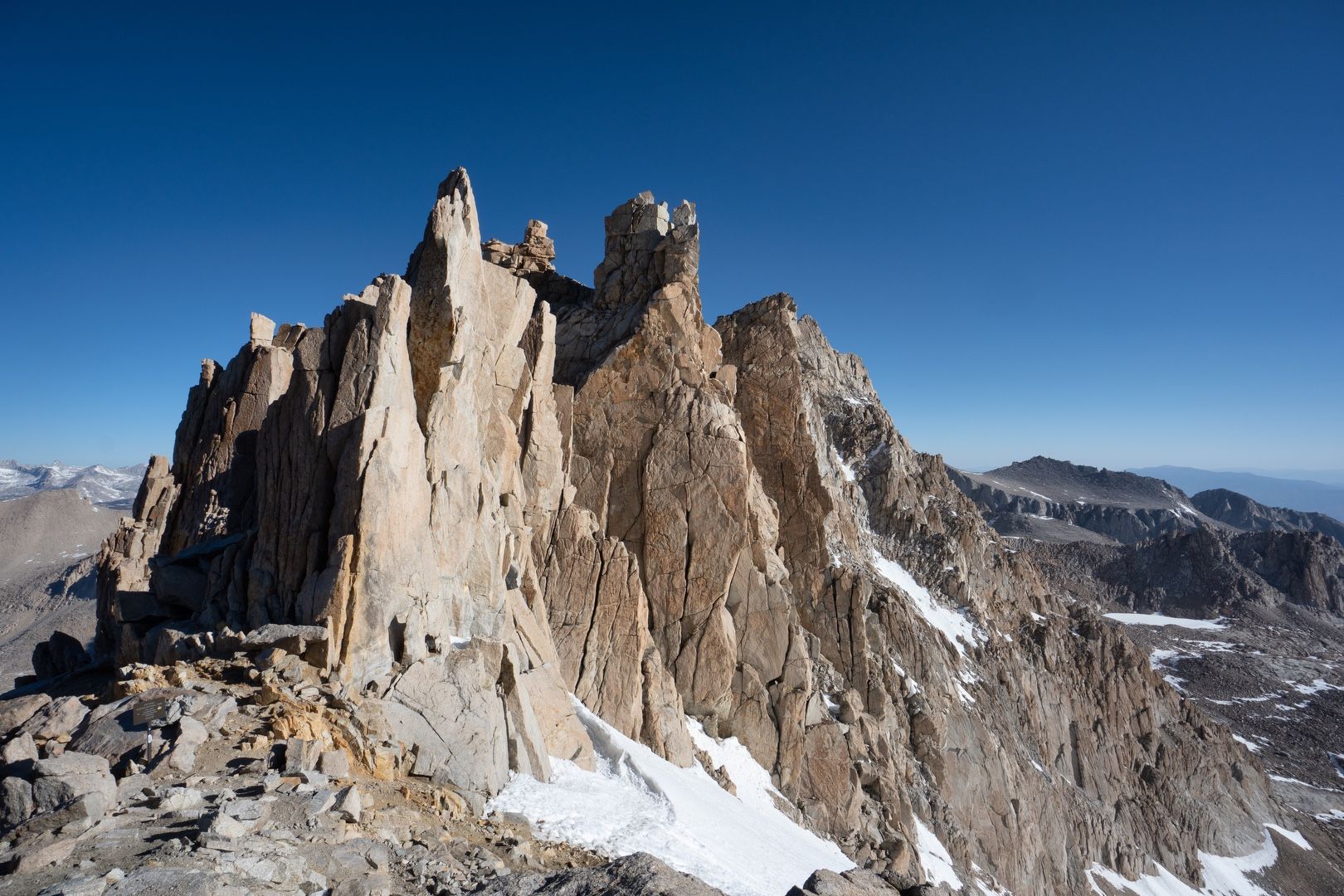
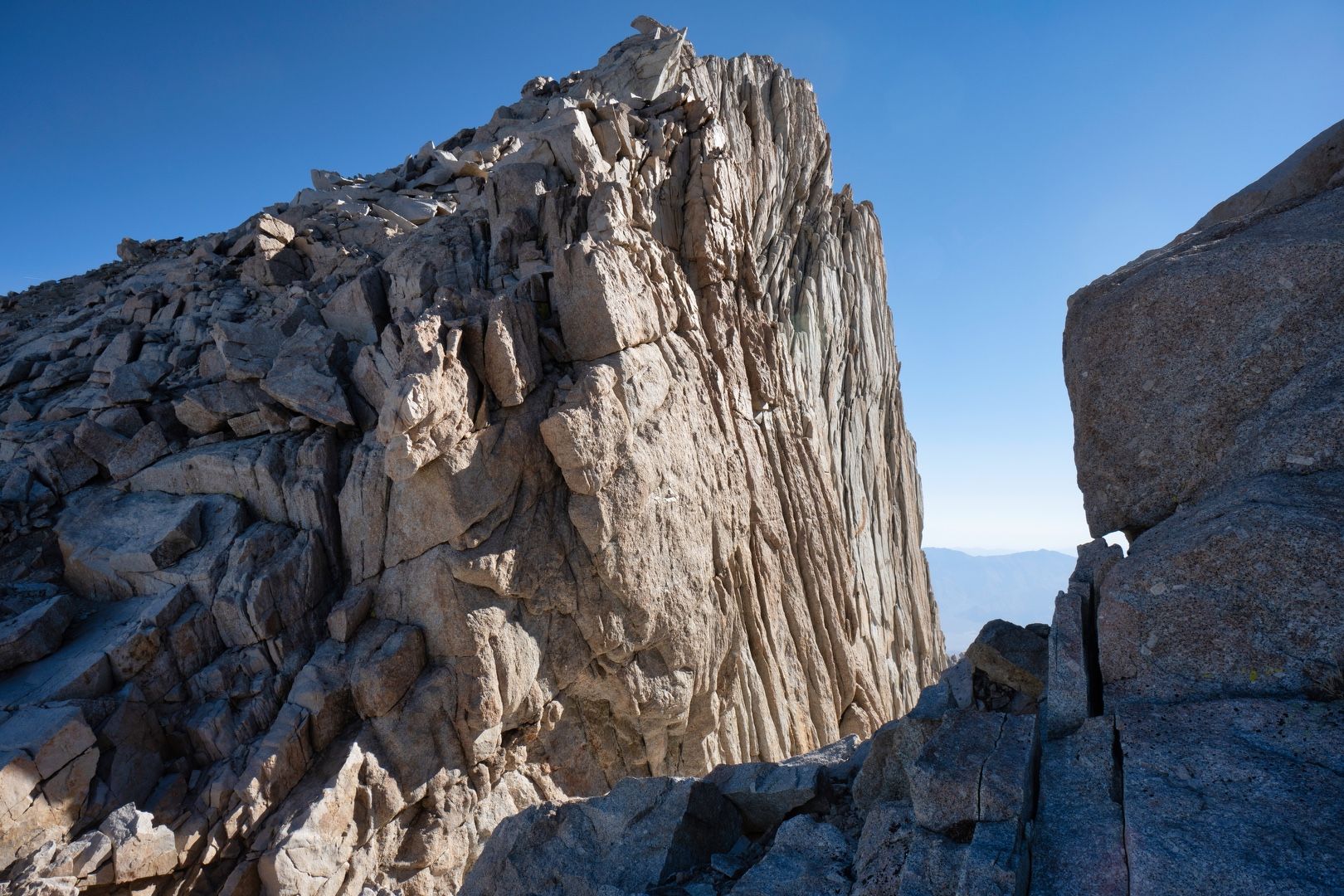
 A granite cathedral
Snow covered the switchbacks at a few points. The “cable” section was actually not very difficult to cross, as it was early and the snow had not begun to melt. Near Trail Crest, I briefly put on crampons to cross another snow-covered section with significant exposure.
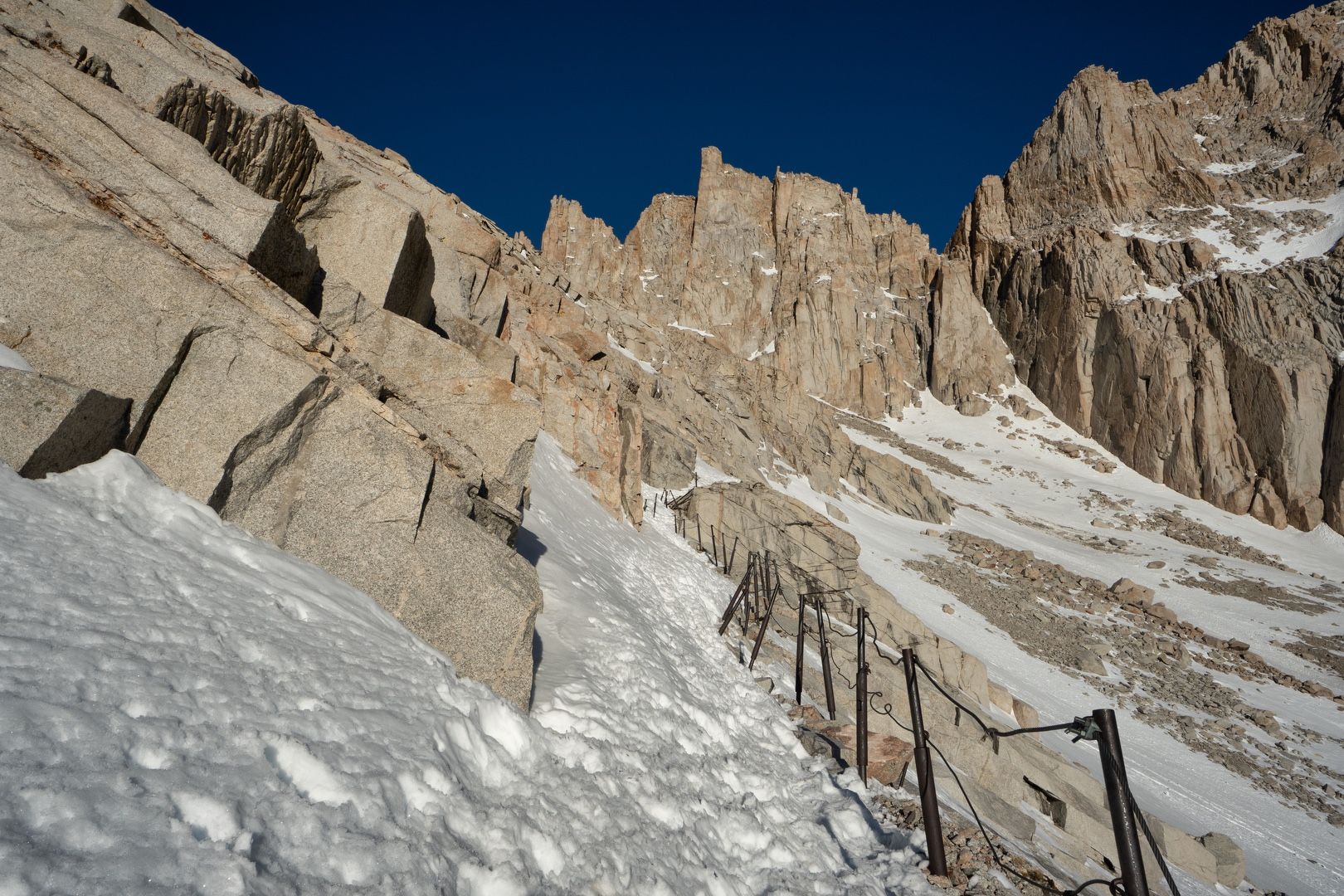 Snow-covered switchbacks
 Arriving at Trail Crest
Beyond Trail Crest, the views to the west opened up bringing Mount Hitchcock and the still-frozen Hitchcock and Guitar lakes into view. Now above 13,000 feet, the air thinned even more and my pace slowed. The trail lost a little elevation beyond the ridge where it joined the terminus of the John Muir trail. A 1.9 mile ridge traverse was all that separated me from the summit.
 Upper and Lower Hitchcock lakes
 Granite cathedral spires
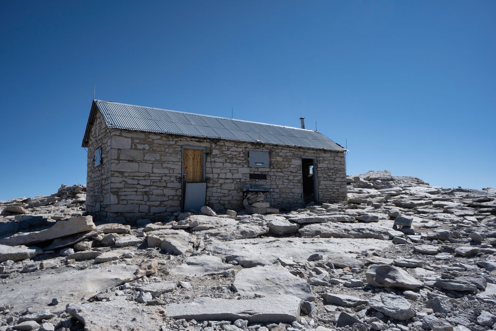
After a long ridge traverse in the thin air, the Smithsonian Institution Shelter appeared on the horizon, marking the finish line. It felt good to finally make it to the top!
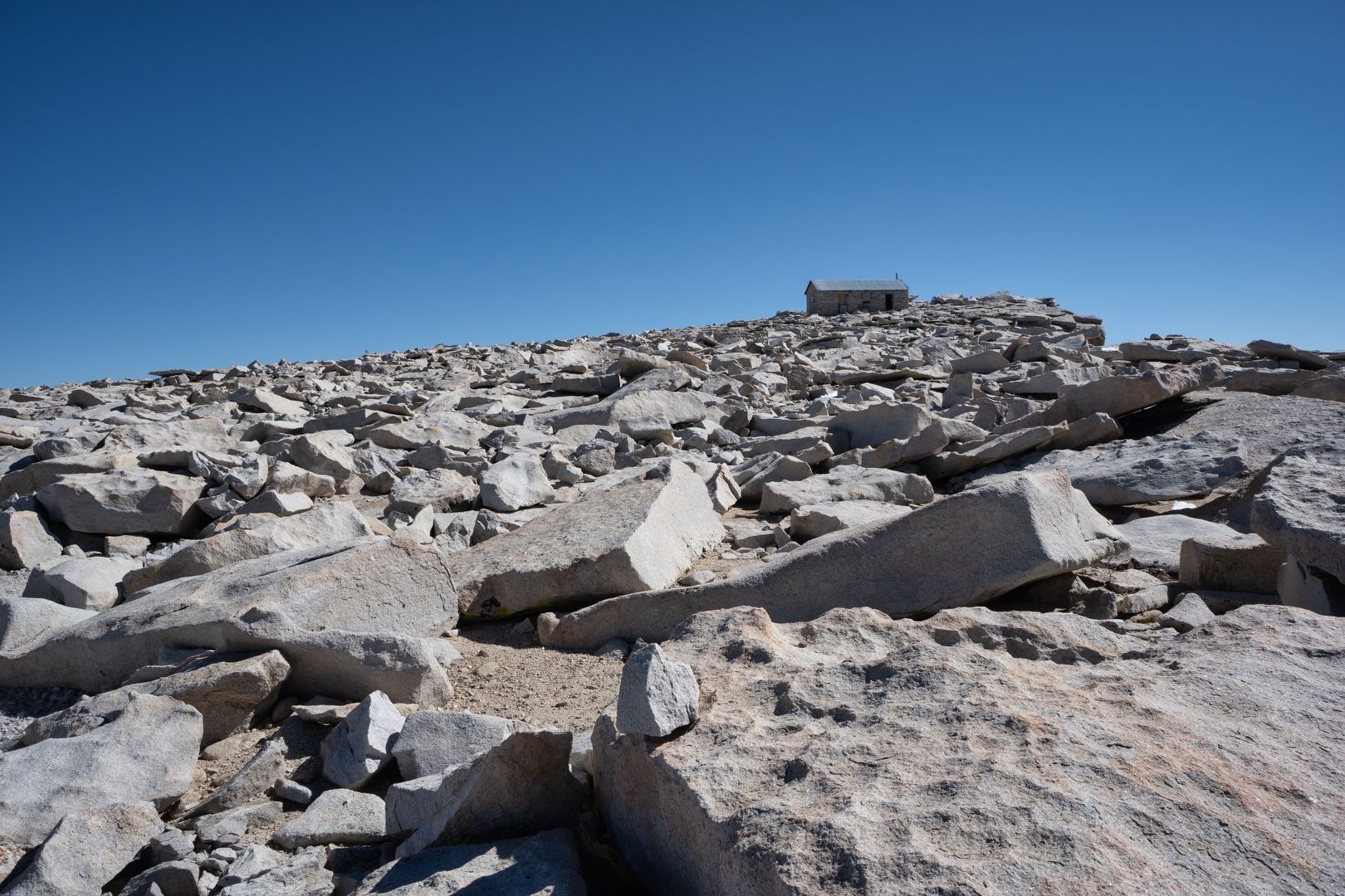 Summit shelter in view
 Arrival
Joining my trail friends Alan and Jolene who arrived a little ahead of me, we took photos and made phone calls to family. I was even able to Facetime my family over a 5G connection!
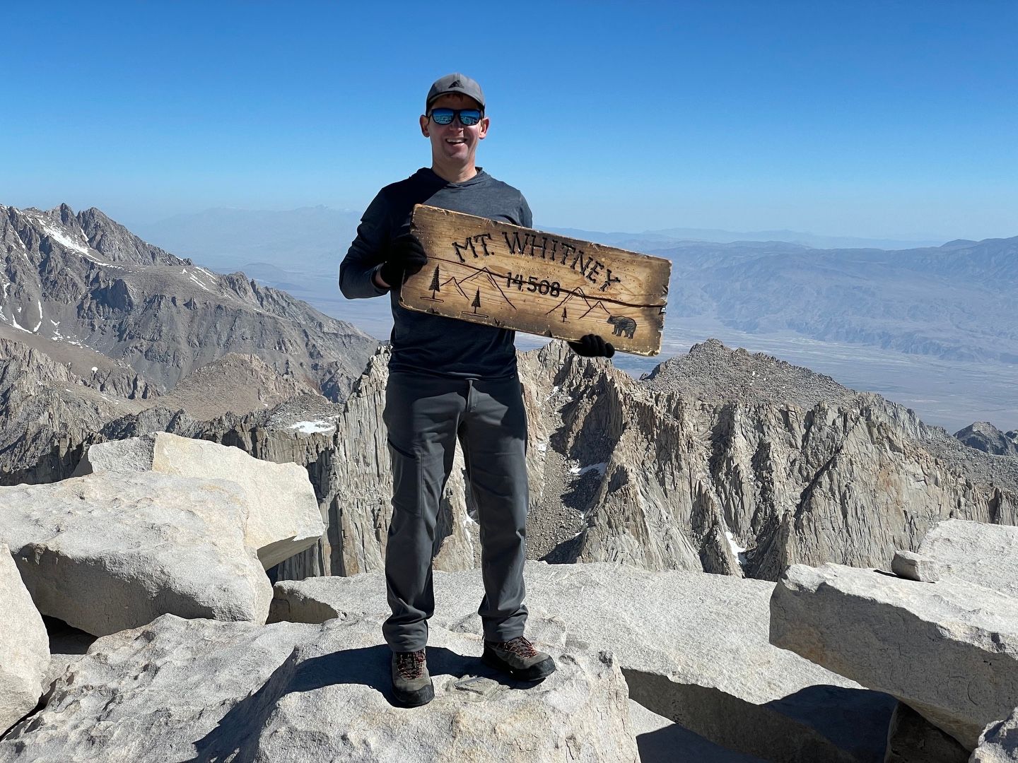 Summit smile
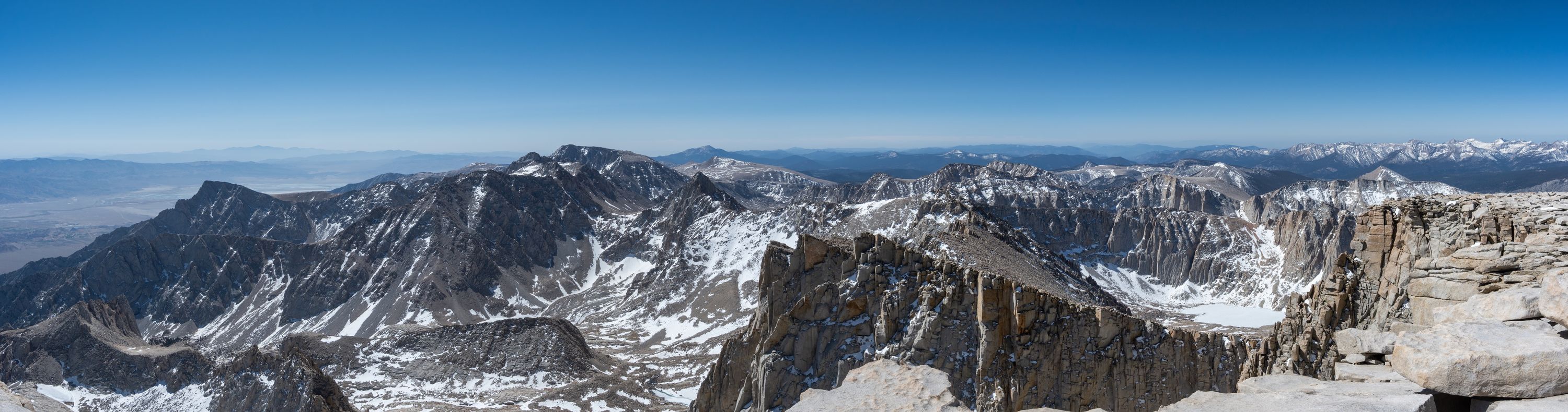 Summit panorama
After soaking up the views, I headed down, making good time to Trail Crest. At this point, I decided to glissade down the chute to avoid the long slog down the switchbacks on softer afternoon snow. Taking this route saved over a mile on the return hike. After a steep glissade requiring my full attention to avoid rocks and excessive speed, I made it back Trail Camp. I packed everything up and headed for the Portal, arriving at about 3:30 PM.
Back in Lone Pine, I enjoyed a burger at The Grill followed by a very good night of sleep.
Starting elevation: 8,324 ft | Elevation gain: 6,321 ft | Distance: 19.97 mi