Platinum Peak
A high pressure system interrupted the usual January storms, but a dense layer of fog blanketed most of the low-lying areas. The weather report called for sunshine at higher elevations and this was all the motivation I needed to go out and find some.
I’d been looking for an opportunity to snowshoe, so I selected the Crystal Mountain snowshoe trail network as my destination. Wanting to get some elevation, I targeted Bullion Basin and Platinum Peak as my objectives.
Arriving just after 9 AM, I loaded my pack alongside the many skiers gearing up in the parking lot. I later realized that I could have parked closer to the snowshoe trails in the “Upper C Lot”, above Lot C. Payment is now required to park on the weekend, but it’s still free on weekdays.
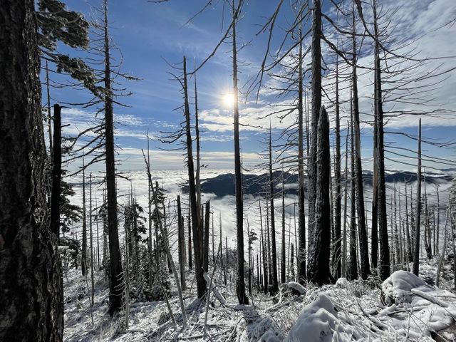
 Good morning, Crystal!
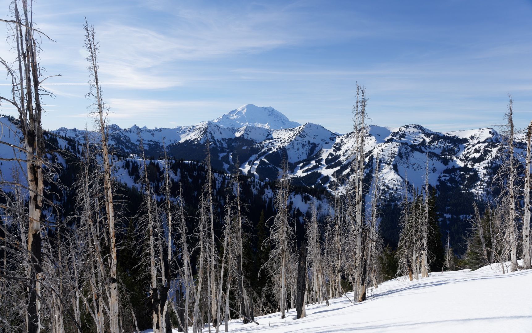
I ambled up the road toward the ski lifts with snowshoes lashed to my backpack, then booted left up the mountain on the “T&T” trail. The snow-covered slope soon transitioned to road walking until the junction with the “Mary Lee” trail. I strapped on my snowshoes and headed off the road, choosing the direct route up “Chutes & Ladders”. After a short but steep climb, I reached a flat area. Angling left through some trees and across a snow bridge over Silver Creek, I joined the upper part of “Ted’s Trail”. The views to the south opened up here, with the trail becoming less steep, making for relatively easy progress until reaching Bullion Basin.
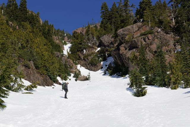
 Looking for bullion in the basin
At the basin, I took a left turn, heading northeast up to the ridge and gaining another 1,000 feet of elevation on 40-degree slopes. The sun-drenched snow was softening by the minute, but my snowshoes kept me on top and the ascender bars significantly aided my ability to climb on the steep terrain.
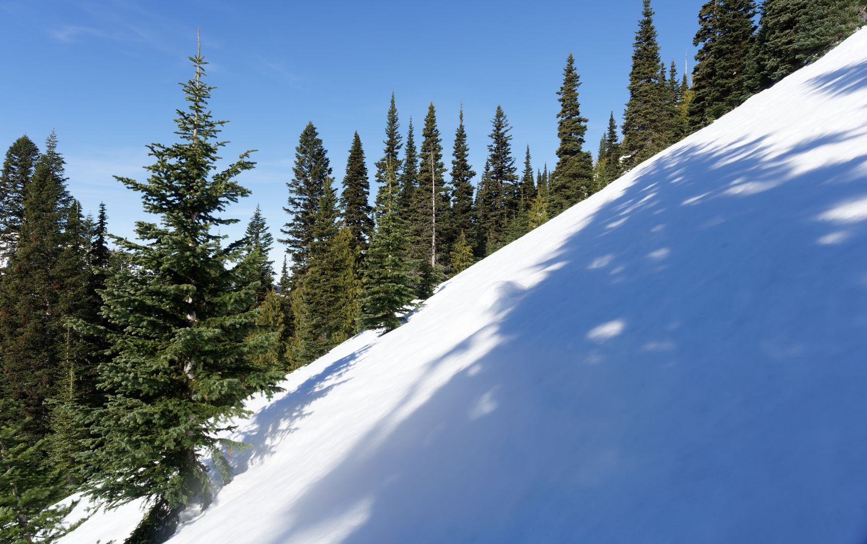 Slog up the slope
Upon gaining the ridge, I was greeted by arresting alpine views to the east and northeast. Heading left along the ridge, I continued the ascent up the ridge to the northwest. The snow became considerably softer and powdery higher up the ridge, ski tracks crisscrossing the surface. Soon I topped out on Platinum Peak and enjoyed jaw-dropping 360-degree views of Mt. Rainier, Mt. Adams, Mt. St. Helens and innumerable Central Cascade ridges and peaks.
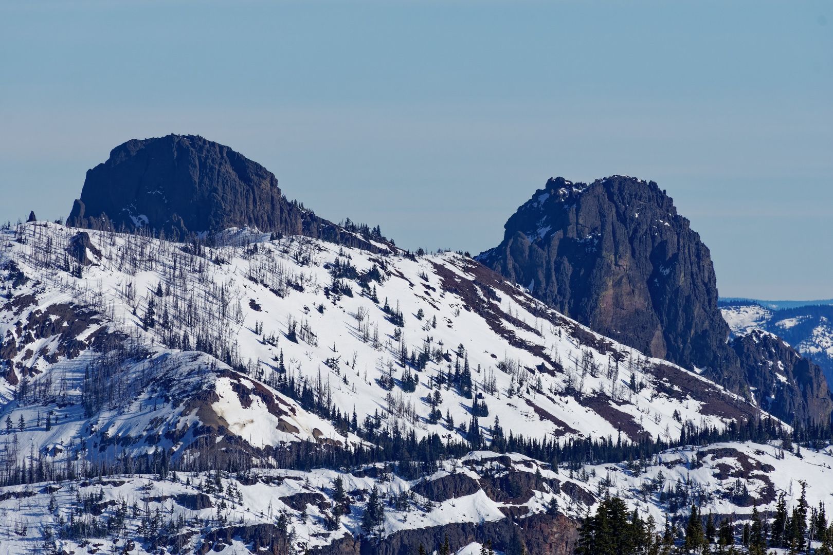 Fifes Peaks peeking out to the NE
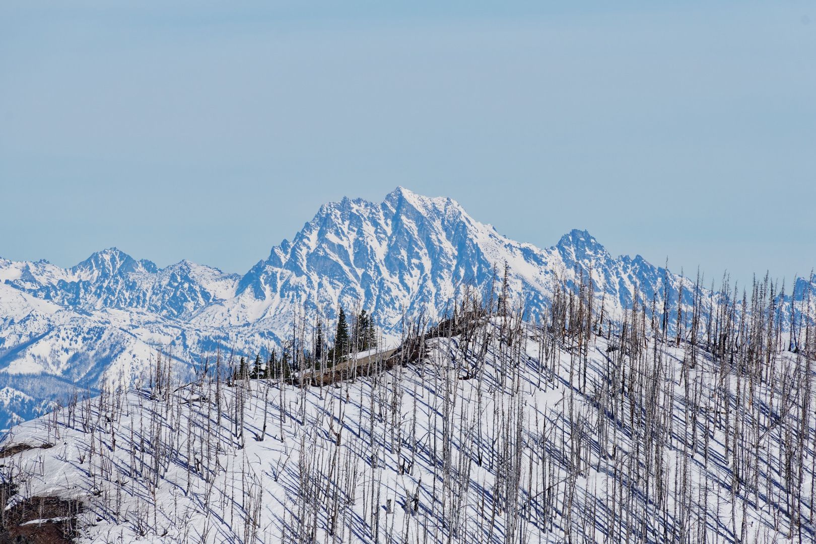 Stuart to the NE
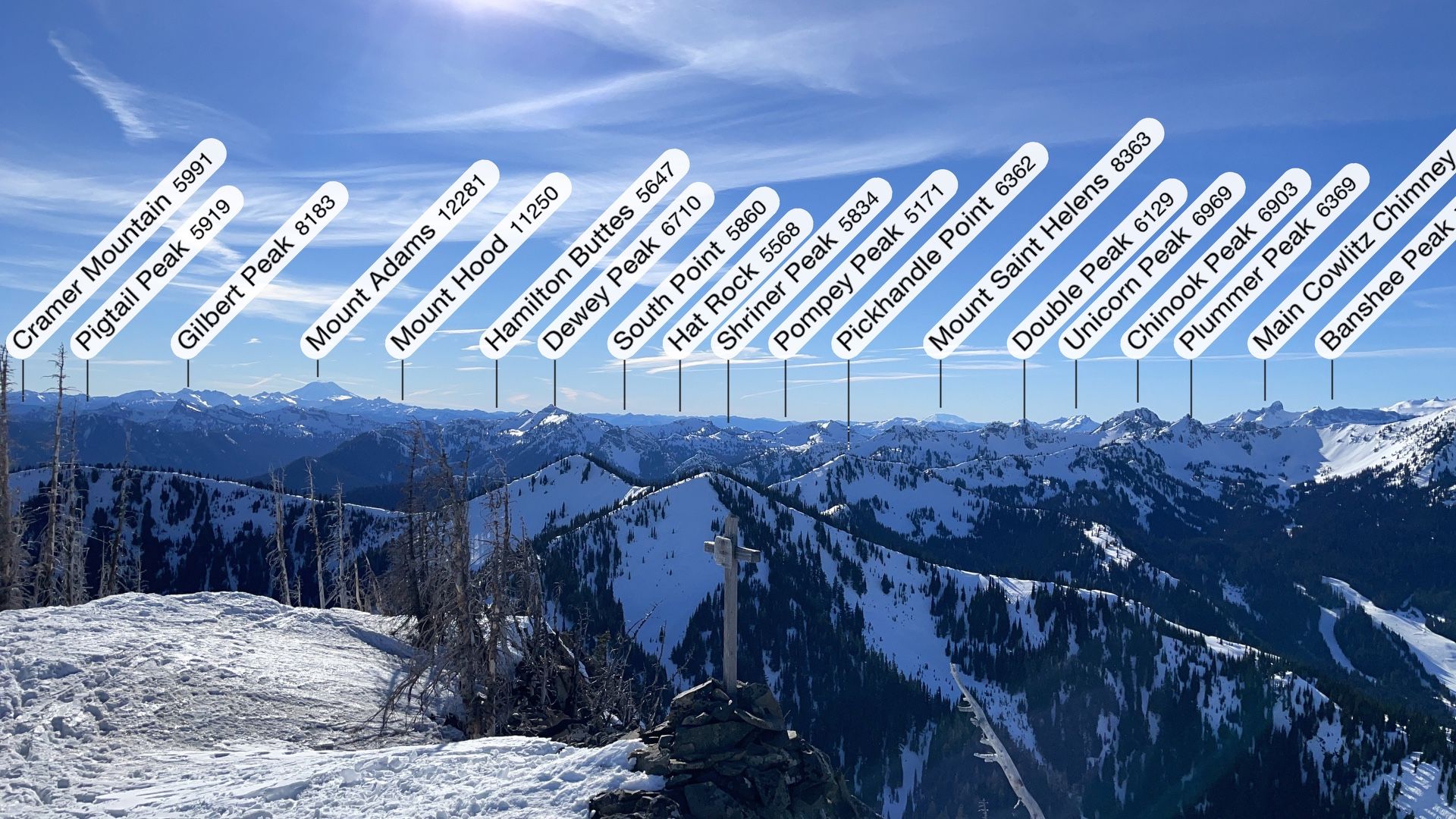 Annotated SE view
Enjoying a summit sandwich and bathed in the rare January sunlight, I soaked up the mountain views. I spotted two climbers arriving on the summit of Norse Peak to the north and watched the ant-like resort skiers below me, surely enjoying their blue bird day.
The good visibility gave me the opportunity to use a telephoto lens for close-up views of Rainier, Adams and St. Helens, all appearing to shimmer in the early afternoon sun.
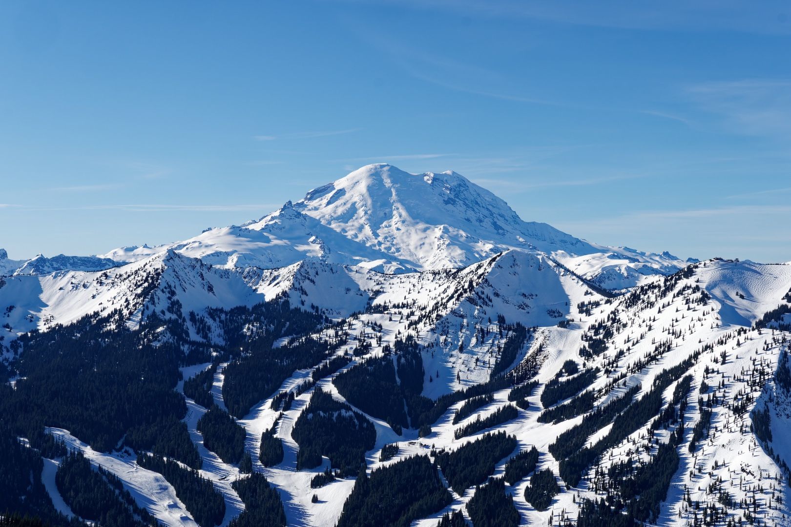 Rockin’ Rainier view
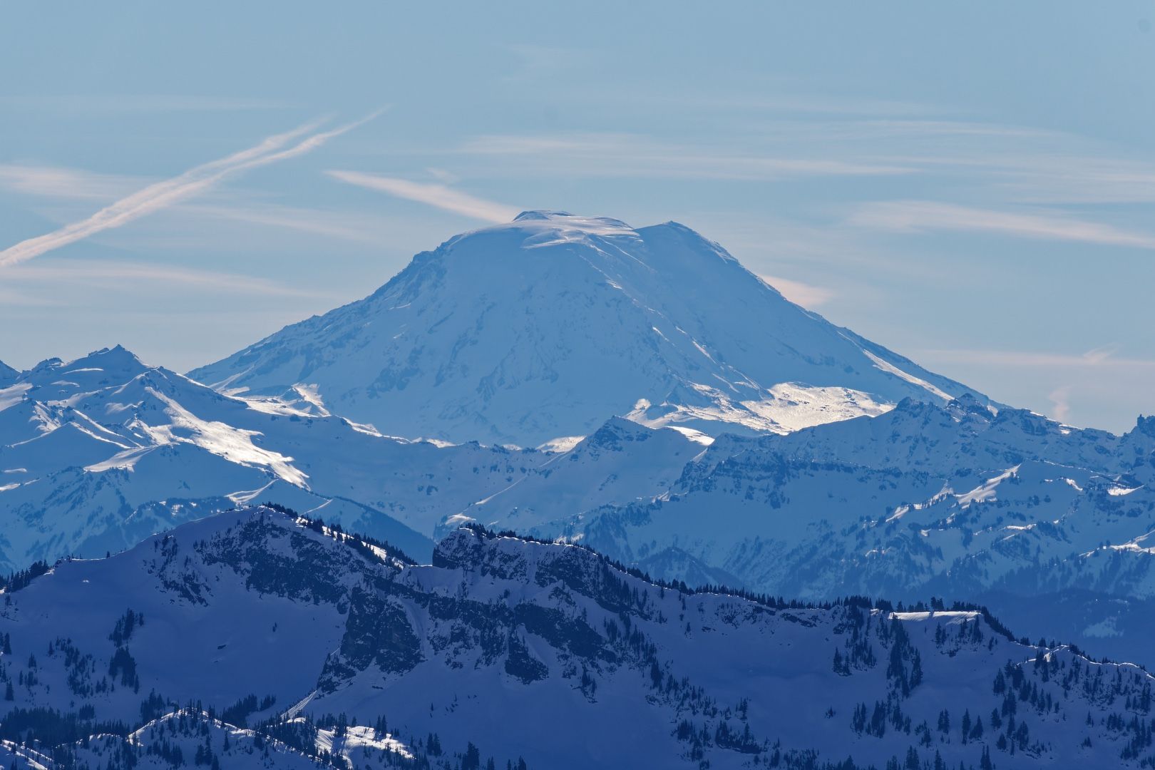 Adams’ north face
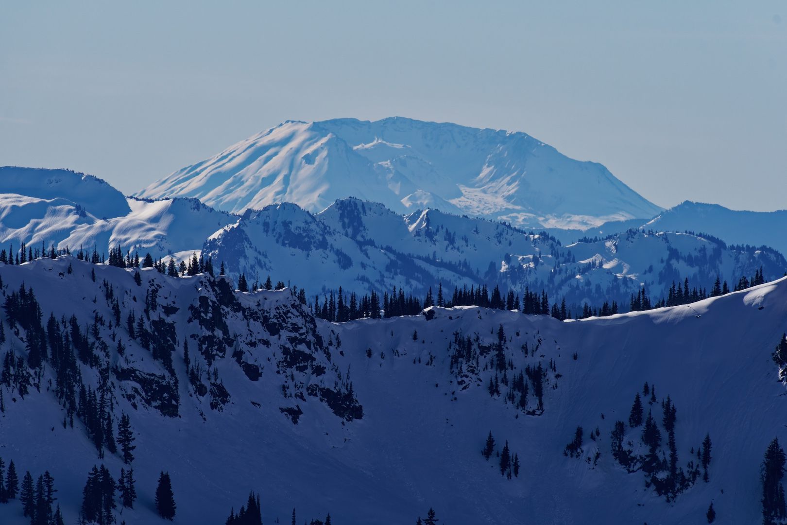 St. Helens to the SE
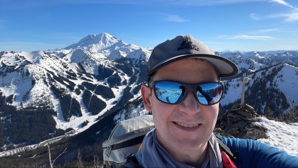 Sunscreen-covered summit selfie
After lingering a while longer, I retraced my steps and headed back down toward Bullion Basin. Due to the steep descent pitch from the ridge, I found it easier to plunge step rather than snowshoe. I postholed and slid a few times, but self-arrested quickly with my ice axe.
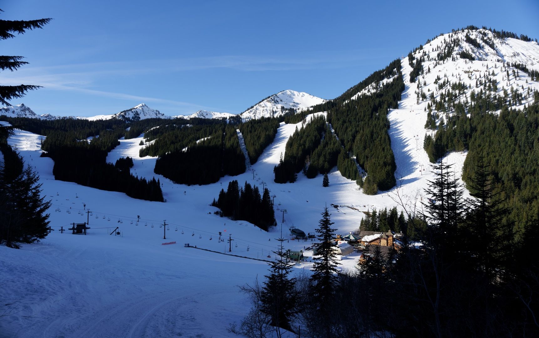
Back at the basin, I enjoyed a leisurely walk down the trail, with peek-a-boo resort views through the trees. I encountered four backcountry skiers along the way, but otherwise had the trails and mountain to myself for the entire day.
 Rainier on the descent
Starting elevation: 4,200 ft | Elevation gain: 2,496 ft | Distance: 5.32 mi